CANAL & SALT MAPPING
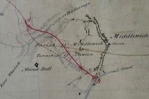
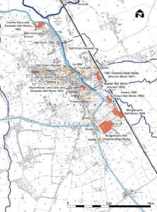
This is a tracing taken from a survey of the Trent & Mersey canal, held by the Staffordshire Record Office that shows the location of various salt works. From later documents it has been possible to attribute names to them. How old the origins of these salt works were we do not know as this is the first evidence we have for the locations of post-medieval salt houses.
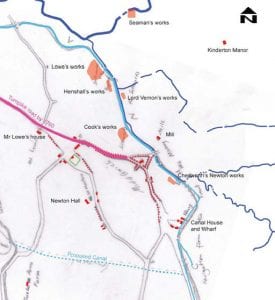
In terms of canal construction the Middlewich Branch of the Shropshire Union Canal is a late enterprise, opening in 1829; although it was one of the first branches of the Canal system to be conceived. The initial concept in constructing such a branch was to link the two main arterial canal networks – the Shropshire Union and The Trent & Mersey Canals. Furthermore, it was hoped that it would open trade with the industries in North Wales. Prior to finalising the route, a plan to construct a canal between Chester and Middlewich was conceived as far back as 1772 when the Chester Canal Company wished to take advantage of the lucrative salt and pottery trades.
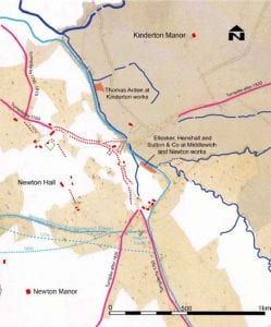
This shows Middlewich before the railway. All canals have been constructed, the Middlewich branch by 1829 and the Wardle Canal by 1833. The suggested alternative routes for the Middlewich Branch are indicated and the Turnpike Roads are shown. The background is the 1840s Tithe Apportionment map with the same housing and street pattern depicted on the 1778 survey and salt works listed in Bagshaw’s 1850 Directory.
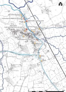
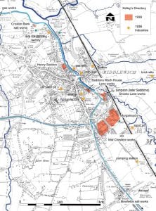
This shows how the same locations that were depicted in the 1778 survey have continued in use as salt works, although ownership has changed significantly. The background map is the 1st edition Ordnance Survey map. It also shows some of the salt related contemporary industries and the Railway which came to the Town in 1868.
This shows a significant change from historic salt works hugging the canal, to the development of much larger chemical works industry on the south side of the town. The importance of the Railway becomes considerably more essential for the economical distribution of salt.
Note the velvet works shown on the 1874-5 map has changed to a fustian works; the silk factory had closed and therefore velvet was no-longer easy to produce, so fustian was manufactured instead. Both velvet and fustian needed salt in their manufacture and finishing.
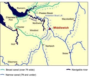
The North West Canal Network
The Trent & Mersey Canal, constructed in 1777 cuts through the eastern partof the town centre, whilst the Middlewich Branch of the Shropshire Union Canal, opened in 1829 cuts through the southern part of the town, linking up with the Trent & Mersey via Britain’s shortest canal, the Wardle Branch which was opened in September 1833.
From the latter part of the 18th century to the latter part of the 20th century Middlewich was a significant junction for canal traffic, especially as the town was built on the wealth from the salt and dairy industries. The three canals link the town with local, regional and world markets. Canals at this time were considered good long-term investments and attracted a number of important industrialists of the day to put their money into these remarkable enterprises.
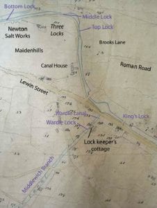
In Close Up…Maidenhills Area
1840 Tithe Map showing the “Dog Leg” of the Trent and Mersey Canal and Three locks area. Note the early existence of Canal House and its outbuildings, plus the Boat Yard South of Kings Lock.
In Close Up…Central Middlewich – The Town Wharf
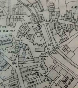
The Town Wharf, east of Leadsmithy Street, dated 1911.The Wharf was much larger before the ‘new’ Town Bridge development, around 10 structures with two yards.
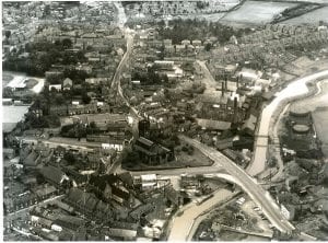
1928 Middlewich aerial v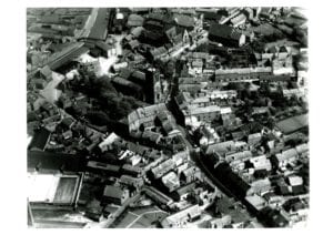
©Owners copyright
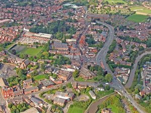
Middlewich aerial view 2008
